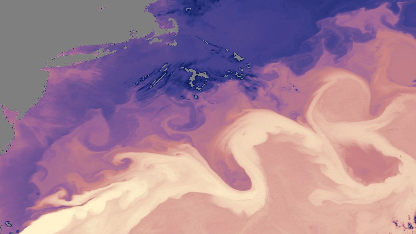
 Image: NASA (data collected by the Moderate Resolution Imaging Spectroradiometer (MODIS) on NASA’s Aqua satellite= (Public domain)
Why the Gulf Stream hugs America and not Europe
Benjamin Franklin printed the first chart of the Gulf Stream in 1769, drawn from the knowledge of his cousin Timothy Folger, a Nantucket whaling captain, to explain to the British Post Office why its mail packets took two weeks longer to reach New York than the merchant ships did. The packets sailed into the current; the merchants knew to cross it. The chart shows a river in the sea, 100 km wide, running up the American coast and then out into the Atlantic. What it does not show, because nobody asked for 180 years, is why there is no such river on the European side. The water that goes north along America must come back south somewhere, and it does, but it comes back across the whole width of the eastern Atlantic as a drift so slow a sailing ship barely notices it. The Canary Current carries roughly as much water as the Gulf Stream does off Florida, spread over 1,000 km instead of 100 and moving at a few centimetres a second instead of two metres.
A pattern in every ocean
The asymmetry is not peculiar to the Atlantic. The North Pacific has the Kuroshio off Japan and the sluggish California Current off America. The South Atlantic has the Brazil Current in the west and the Benguela in the east, the South Pacific the East Australian Current and the Humboldt, the Indian Ocean the Agulhas off Africa. In every basin the strong current is on the western side, flowing away from the equator, and the return flow in the east is broad and weak. Oceanographers call this western intensification, and until 1948 there was no accepted reason for it.
What the wind does
The gyres are driven by the wind: the trade winds blowing westward in the tropics and the westerlies blowing eastward at mid-latitudes together spin the water of the subtropical basin clockwise in the Northern Hemisphere. If the wind were the whole story, the circulation would be symmetric, a slow clockwise drift everywhere. Harald Sverdrup showed in 1947 that the wind's torque sets how much water flows north or south in the interior of the basin, and it does, but his relation says nothing about where the return flow goes. Something had to close the loop.
Stommel's page
Henry Stommel, then 28 and working at the Woods Hole Oceanographic Institution, published a short paper in 1948 called "The westward intensification of wind-driven ocean currents". He imagined a rectangular ocean of uniform depth, drove it with a simple wind, let friction at the bottom slow the water, and solved the equations three times. With the Earth not rotating, the gyre was symmetric. With the Earth rotating but the Coriolis effect the same everywhere, the gyre was still symmetric. With the Coriolis effect growing from the equator towards the pole, as it does on a sphere, the gyre swung over to the west and a narrow fast current appeared along the western wall. The cause was not the rotation itself but its variation with latitude.
The quantity that varies is the Coriolis parameter \(f = 2\Omega \sin\varphi\), where \(\Omega\) is the Earth's rotation rate and \(\varphi\) the latitude. Its rate of change with distance northward is written \(\beta\), and the explanation is now called the beta effect. The argument in words goes like this. The wind puts clockwise spin into the water of the gyre, and that spin has to be removed somewhere, or the gyre would speed up without limit. Friction can remove spin only where the current is fast, which means in a narrow boundary current. Now consider a water column moving north along the western side of the basin. As it goes north, \(f\) grows, and the column must acquire anticlockwise spin relative to the Earth to compensate, which is exactly the opposite of the clockwise spin the wind gave it. Friction in a western boundary current therefore works with the beta effect to cancel the wind's spin. On the eastern side a southward-flowing boundary current would do the opposite and add to the problem. Only the western solution balances, so that is where the fast current is.
Walter Munk extended the model in 1950 with a more realistic wind and a different kind of friction, and got the same answer with the Gulf Stream in the right place and roughly the right width. The width of Stommel's current is set by how fast friction can act against the beta effect; for the real ocean it comes out at some tens of kilometres, close to what is measured.
The numbers
Oceanographers measure a current's transport in sverdrups, written Sv, one sverdrup being a million cubic metres per second. All the rivers of the world together carry about 1.2 Sv into the sea, and the Amazon alone about 0.2 Sv. The Gulf Stream carries about 32 Sv through the Straits of Florida, where it has been measured by a submarine cable since 1982, and about 90 Sv off Cape Hatteras, where it has picked up water recirculating from the open Atlantic. At its core it moves at about 2 m/s, a fast walk, through a cross-section about 100 km wide and 1,000 m deep. Check the product: \(2\ \mathrm{m/s} \times 100{,}000\ \mathrm{m} \times 1{,}000\ \mathrm{m}\) is \(2 \times 10^{8}\) m³/s, or 200 Sv, and the real figure is lower because the speed falls off quickly away from the core and with depth. The Canary Current, by contrast, moves at 0.1 to 0.2 m/s over a width of 1,000 km and a depth of a few hundred metres, and carries a few tens of sverdrups back south without anyone on a ship feeling it.
The same beta effect appears everywhere in the ocean's dynamics. It makes the long waves called Rossby waves travel west, it sets the slow westward drift of eddies, and it is the reason the response of the equatorial Pacific to a change in the wind is asymmetric in the way that drives El Niño. Stommel's page was the first place it did work that anyone could see on a map.
You can see the asymmetry yourself. The Copernicus Marine viewer maps the sea surface height, and the dome of the subtropical gyre sits far over to the west in every basin, with the current crowded against its steep western flank.
Unit 5 of the Ocean Masterclass, the free sample unit, covers the Coriolis effect, Ekman's spiral, the gyres, and western intensification in Stommel's own terms, with the Franklin chart as an excursion. The full list of units is in the curriculum.