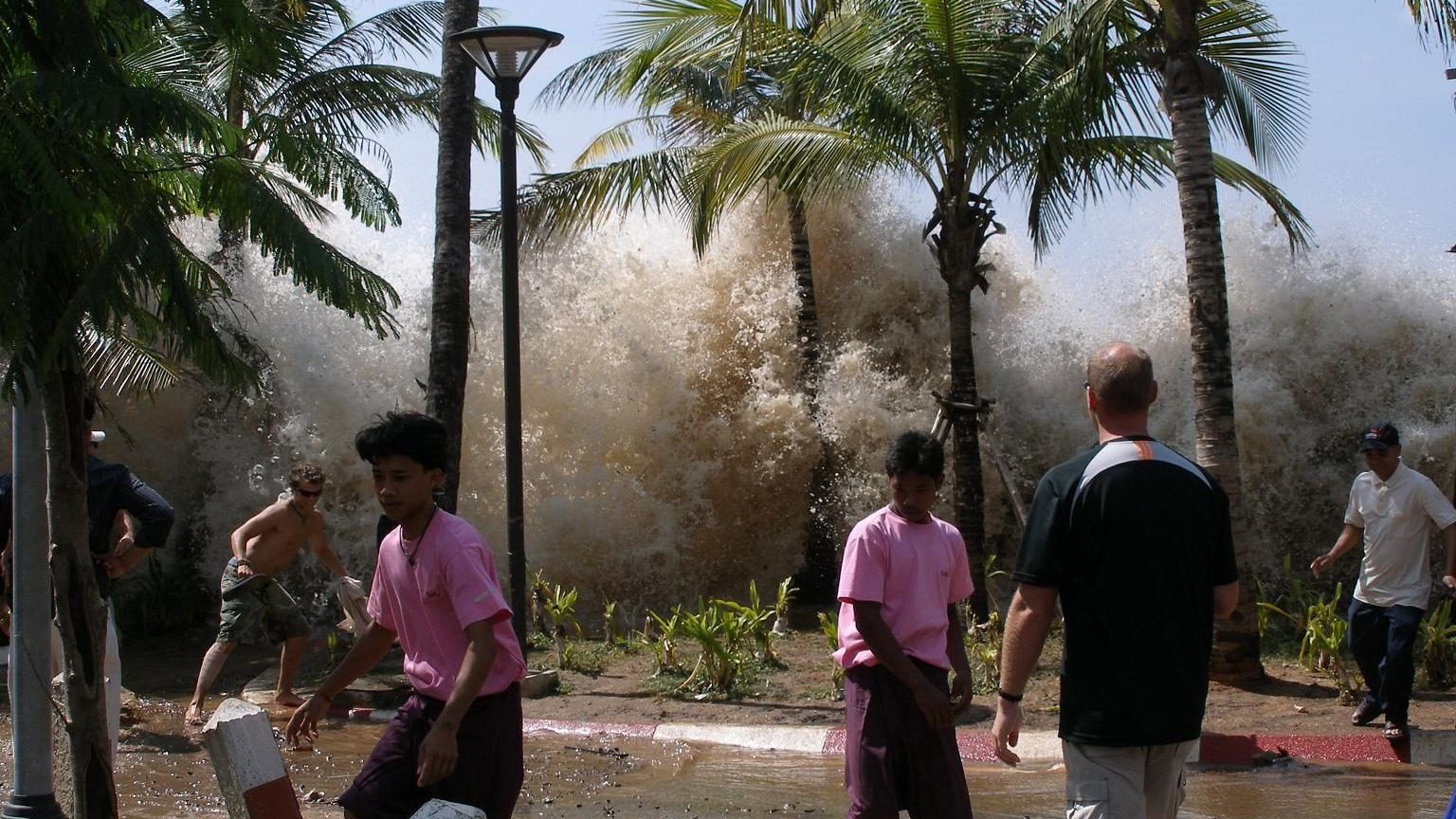
 Image: David Rydevik (email: david.rydevikgmail.com), Stockholm, Sweden. (Public domain)
How fast does a tsunami travel?
At 07:59 local time on 26 December 2004 the seafloor off the west coast of Sumatra broke along a length of about 1,300 km and lifted by several metres. The sea above it, about 4 km deep, rose with it, and a wave spread outward in every direction. It reached the Sumatran coast within 20 minutes, Thailand in about two hours, Sri Lanka in a little over two hours, and the coast of Somalia, 5,000 km away, in about seven. More than 220,000 people died. The times were not surprising to anyone who knew the physics; they could have been written down in advance with one formula, and the reason they were not written down anywhere useful is the story of why the Indian Ocean now has a warning system.
A wave that always feels the bottom
Water waves come in two kinds, depending on how their wavelength compares with the depth. Waves much shorter than the depth, which is every wind wave in the open ocean, do not feel the bottom, and their speed depends on their wavelength. Waves much longer than the depth feel the bottom everywhere, and their speed depends on the depth alone:
\[ c = \sqrt{gH}, \]where \(g\) is the acceleration of gravity, 9.81 m/s², and \(H\) the water depth. A tsunami has a wavelength of 100 to 500 km, because the patch of seafloor that moves is that large, and the ocean is only 4 km deep, so the tsunami is a shallow-water wave even over the deepest ocean. That is the whole trick. Put in \(H = 4{,}000\) m and the speed is \(\sqrt{9.81 \times 4{,}000} = 198\) m/s, which is 713 km/h, about the cruising speed of a jet airliner. Over the 50 m of a continental shelf the speed drops to \(\sqrt{9.81 \times 50} = 22\) m/s, or 80 km/h, and in 10 m of water near a beach to 36 km/h, which is still faster than a person can run.
Checking it against 26 December 2004
The eastern coast of Sri Lanka lies about 1,600 km west of the rupture, across the Bay of Bengal, which is mostly 3,000 to 4,000 m deep. At an average speed of about 650 km/h the crossing takes about two and a half hours. The tide gauge at Colombo, on the far side of the island, recorded the first rise at about 10:30 local time, two hours after the earthquake and a little later on the east coast, which is the time the formula gives. Phuket, in Thailand, is only about 600 km from the rupture but lies across the Andaman Sea, which is shallower, so the wave took almost as long, close to two hours. The wave reached Somalia at about 15:00 local, seven hours after the earthquake, having crossed 5,000 km of deep Indian Ocean at about 700 km/h. In each case the shallow-water speed, applied along the path, gives the arrival time to within ten or fifteen minutes.
Two hours after the earthquake, by chance, the altimeter satellite Jason-1 crossed the Bay of Bengal and measured the wave in the open ocean. It was about 60 cm high. A ship at sea would have risen by half a metre over ten minutes and sunk back over the next ten, and nobody on board would have noticed.
Why it grows at the coast
The energy of a wave travels with it, and in shallow water the energy travels at the wave speed. As the wave slows down over the shelf, the energy that arrived at 700 km/h has to be carried away at 80 km/h, so it piles up, and the wave gets higher. A rule attributed to George Green in 1838 says that, if no energy is lost, the wave height grows as the inverse fourth root of the depth:
\[ \frac{H_2}{H_1} = \left(\frac{h_1}{h_2}\right)^{1/4}. \]A wave 60 cm high in 4,000 m of water becomes \(0.6 \times (4{,}000/10)^{1/4} = 0.6 \times 4.5 = 2.7\) m high in 10 m of water by this rule, before the final run-up on the beach, where the water keeps coming for ten minutes because the wavelength has shrunk but is still tens of kilometres long. Real coasts focus the wave in bays and around headlands, and the measured run-up in Aceh, nearest the rupture, exceeded 30 m in places. The first sign at many beaches was the sea withdrawing, because a trough arrived before the crest; people who walked out to look at the stranded fish were caught by the crest that followed.
From a guess to a forecast
The Pacific had a warning centre in Hawaii since 1949, but in 2004 it had no sea-level data from the Indian Ocean, no agreed way to reach the countries around it, and no way to tell whether the earthquake had made a wave at all. Earthquakes of the same size do not all make tsunamis; it depends on how the seafloor moves. The Pacific Marine Environmental Laboratory of NOAA had by then developed the DART buoys, pressure sensors on the seafloor that detect the centimetre-scale pressure change of a passing tsunami in deep water and relay it by satellite, and a model that runs faster than the wave. Vasily Titov, who led the modelling, and his colleagues used the first DART detection of a Pacific tsunami in 2003 to cancel a false alarm. After 2004 the network grew from six buoys to about sixty, the Indian Ocean got its own centres in 2011, and a tsunami forecast today is a map of expected arrival times and heights issued within minutes of a large earthquake.
The physics has not changed since Green. What has changed is that the measurement now arrives before the wave, and the formula, applied by a computer to the real bathymetry, turns the measurement into a time and a height for every coast in its path.
Unit 6 of the Ocean Masterclass derives the full dispersion relation of water waves and its deep and shallow limits, works the 2004 arrival time at Sri Lanka as an example, and presents the warning system in a research spotlight. The full list of units is in the curriculum.